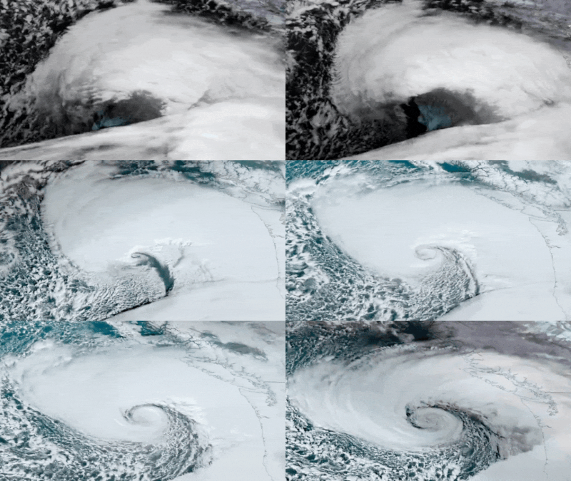
An “incredible” satellite image recently revealed the massive bomb cyclone intensifying over the Pacific Northwest. This swirling system can be easily identified by its rapid intensification, as seen through satellite imagery.
Two fatalities were reported after falling trees struck a homeless encampment in Lynnwood, Washington, and a home in Bellevue.
The storm brought hurricane-force winds, torrential rain, and heavy snowfall, leading to widespread power outages, school closures, and hazardous conditions in the western and northwestern US.
Latest updates on the storm
- Severe rainfall and flooding risks: Northern California and southwestern Oregon are under flood watches until Saturday, with up to 16 inches (40 cm) of rainfall expected. Flash floods, rockslides, and debris flows pose significant threats.
- Heavy snowfall and
blizzard warnings : The northern Sierra Nevada is forecasted to receive 15 inches (38 cm) of snow, with mountain winds gusting up to 75 mph (120 kph). Near whiteout conditions are predicted in pass-level areas. - Power outages and disruptions: Over 6,00,000 homes and businesses across Washington, Oregon, and California experienced outages. Recovery efforts are ongoing, but some areas remain without power.
- Transportation chaos: Southbound Interstate 5 near the Oregon-California border has been shut due to extreme conditions, and other highways face closures and delays.
- Impact in Canada: The storm extended its reach to British Columbia, cutting power to 225,000 residents on Canada’s Pacific Coast.
Residents have been urged to avoid travel in affected regions and prepare for further disruptions as the system remains stationary over northern California.
What is a bomb cyclone?
A bomb cyclone is a rapidly intensifying storm characterised by a significant drop in atmospheric pressure of at least 24 millibars within 24 hours, a process known as bombogenesis. This phenomenon occurs when cold polar air collides with warm tropical air, generating intense weather systems comparable in strength to hurricanes.
Meteorologists report that the current storm experienced a dramatic pressure drop to around 942 millibars, intensifying its impact. The system also aligns with an atmospheric river, a massive plume of tropical moisture, bringing torrential rains and high winds.
Bomb cyclones, although not uncommon, can cause severe damage due to their rapid development and wide-reaching effects. This storm underscores the importance of staying vigilant and prepared during extreme weather events.
Authorities continue to monitor the situation, urging residents in vulnerable areas to heed warnings and prepare for potential evacuations.
