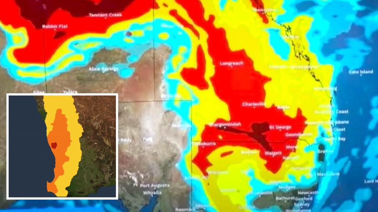
Millions of Australians – from the east to west coasts – are in for a wild week of weather.
In the west, Perth is looking at a punishing heatwave which could see some suburbs hit 40C.
In the east, a prolonged multi-day severe thunderstorm event is in progress which could lead to heavy rain, large hail and damaging winds from Queensland to Victoria via New South Wales.
“We’re likely to see multiple days of severe thunderstorm warnings across large parts of northern and eastern Australia,” Bureau of Meteorology (BOM) meteorologist Dean Narromore said.
Brisbane could see up to 20mm of rain on Tuesday alone and Canberra 10mm.
This week, accumulated totals of 50mm will be normal across northern NSW and southern central Queensland as well as the Wide-Bay Burnett region.
Around New England in NSW, those totals could get up to 100mm or even 200mm in isolated areas.
Sky News Weather meteorologist Rob Sharpe said fires had been discussed “endlessly” over the past couple of months, but rain was on its way to those affected areas.
“We’re seeing the rain over the eastern inland regions, many of which are in drought or heading into drought,” he said.
However, the storms and rain might not be constant. Much of the instability is patchy and there could be breaks in the inclement conditions.
In Brisbane, the rain is set to lessen as the week continues with a few spots here and there after Tuesday and highs of about 27C.
Bundaberg and Rockhampton could continue to see heavy falls and storms on Tuesday. But it’s central Queensland that could see ongoing very wet weather.
Repeating storms are forecast for Charleville with up to 25mm of rain each day between now and Thursday.
Over the border, the north of NSW is set to be soaked with Moree seeing as much as 30mm on Thursday and plenty of rain either side of that too. Grafton is set to receive north of 35mm this week.
A few showers are due on Tuesday in Sydney with a 26C high. That will be followed by a mostly sunny Wednesday but then more rain on Thursday and Friday and then even heavier falls for the weekend.
Canberra is forecast to see as much as 10mm of rain on Tuesday but that will lessen for Wednesday and Thursday. There will be highs in the capital this week of 27C.
It will be a mostly dry weekend in Melbourne but a possible shower could come through on Tuesday. Today and Wednesday are set to peak at 20C but by Friday expect a 27C maximum.
Bobbing around the 20C mark in Hobart with mostly dry days and some cloud.
Adelaide is also looking dry with temperatures topping out at 26C on Thursday but rain falls, some heavy, could reappear on Friday.
Severe heatwave for Western Australia
Western Australia is going to absolutely bake this week.
A heatwave warning is in place from Augusta to Exmouth – including Perth, Bunbury and Geraldton – from Tuesday until Friday.
“Perth is sitting well and truly in those severe heatwave conditions,” the BOM’s Angus Hines said.
Close to Perth it could even reach an extreme heatwave.
“On Tuesday we really see the temperatures crank up a notch in Perth to 36C,” he said. “But Wednesday is the day of peak heating with 39C in Perth.
“I wouldn’t rule out 40C in some of those suburbs.”
Geraldton could see 40C on Tuesday and close to that on Wednesday and Thursday as well as the weekend. In Exmouth expect 43C on Thursday.
As usual the place to escape the heat will be the far south west of the state with Albany only getting as high as 26C on Friday.
Darwin will see 35C highs this week with storms from Wednesday onwards bringing some rain here and there. As much as 10mm could fall on Friday.
– with Fergus Ellis
