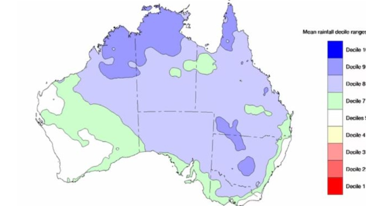
Aussies could be in for more rain, with the country now officially on La Niña watch just a month after El Niño wrapped up.
In what will be unwelcome news for some, the Bureau of Meteorology (BoM) confirmed early signs that a La Niña might form in the Pacific Ocean later this year.
During La Niña, cooler sea temperatures in the eastern Pacific push trade winds westwards which in turn moves warmer waters to Australia’s east coast. This creates more clouds, leading to more rain.
“When La Niña Watch criteria have been met in the past, a La Niña event has subsequently developed around 50 per cent of the time,” BoM’s climate driver update said.
“There is about an equal chance of neutral ENSO (El Nino Southern Oscillation) conditions in the same outlook period.”
The country experienced three consecutive La Niña events between 2020 and 2022, before going through an El Niño event last summer, which ended in April.
If a La Nina does re-emerge it could cause problems as the ground of eastern Australia is still moisture laden from the last La Nina, exacerbating any flooding.
But increased rainfall could still be a while away, with Sky News senior meteorologist Rob Sharpe predicting La Niña will likely result in more rainfall in spring.
“Through winter, dryer than usual weather is likely for the northwest and for the southern coastline and there’s only a small tendency towards wetter than usual (conditions) for parts of the east of the country,” Mr Sharpe told Sky News on Wednesday.
“Through winter I’m thinking near-normal rainfall but temperatures well above the usual. But as we move into spring, I think we’ll have more of an influence from La Niña and more rainfall.”
El Nino and La Nina are the two extremes of the El Nino Southern Oscillation (ENSO) climate driver.
ENSO phases are defined by a combination of sea surface temperatures in a patch of the eastern Pacific Ocean called Nino3.4 as well as wind and air pressure measurements.
The Bureau suggested ENSO will likely remain neutral until at least July.
“It is important to emphasise that early signs of La Niña are most relevant to the climate of the tropical Pacific, and that the long-range forecast for Australian rainfall and temperature provides better guidance for local climate,” it said.
